

The Magic of Light – Using spectroscopes and colour wheels to study the properties of light
Brief description In this set of eight activities, pupils work individually or in groups to build a spectroscope that can...

One year on Earth – Understanding seasons
Brief description This resource includes two activities to foster and enhance pupils’ knowledge of seasons, and focuses on the basic...

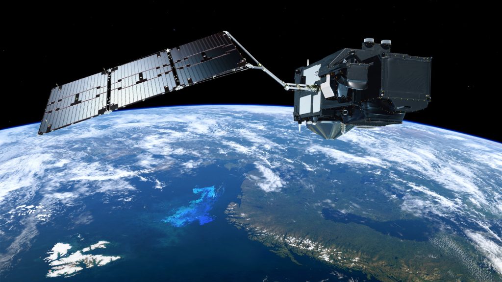
Radar vision
Discover how Copernicus Sentinel-1 mission uses its radar to provide an all-weather, day-and-night supply of imagery of Earth’s surface.

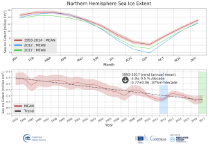
Learn about sea level
Learn how climate change is causing our seas to rise and how satellites have been measuring the height of the sea surface systematically since 1992.

What are the differences
In this short video, Dr Natalie Douglas, a climate scientist, explains the difference between weather, climate variability and climate change. Natalie is a Teaching and Research Fellow at the University of Surrey and is collaborating...
Taking the Pulse of the Planet- Upper secondary
Brief description In this set of three activities, students will learn about how data is collected by sensors and how...