From the Ground and from the Sky- Analysing and understanding images of planet Earth taken from space
In this set of three activities, pupils are introduced to the idea of remote observation of the Earth from space. They are asked to match photographs of different landscapes (mountains, lakes, rivers, cities, islands, and deserts) taken from the ground with photos of the same places taken by astronauts onboard the International Space Station, and also with photos taken by Earth Observation satellites. In particular, this resource uses photos from Sentinel-1 and Sentinel-2, missions that have been developed by ESA as part of the Copernicus programme.
Subject Geography, Science
• Learn about the different perspectives from which you can observe an object
• Investigate the difference between photos taken from the ground (on Earth) and images taken from space
• Find out what lakes, mountains, rivers, islands, deserts, and cities look like from space
• Discover the advantages and importance of taking images from space with Earth Observation satellites
• To analyse images and extract relevant information
• To associate different objects based on a set of criteria
• To work together and share conclusions
![](https://climatedetectives.esa.int/wp-content/uploads/2023/08/Figure-A11-1024x679.jpg)
![](https://climatedetectives.esa.int/wp-content/uploads/2023/08/Figure-A22.jpg)
Did you know?
Earth observation satellite images are extremely useful, for example for
making detailed maps, checking for variations in vegetation, monitoring
pollution, helping to predict the weather, and much more! Sometimes
the final images can look quite strange. For example the image on the
right shows a glacier. It is actually made up of three images taken over
a period of seven weeks. The grey colours represent parts that have not moved during this period, and the bright colours represent parts that have moved or changed in different ways during this time.
![](https://climatedetectives.esa.int/wp-content/uploads/2023/08/Activity-3-Did-you-know-2-300x293.jpg)
Infrared Webcam Hack – Using infrared light to observe the world in a new way
Brief description This set of three activities will enable students to understand the electromagnetic spectrum and observe infrared radiation through...
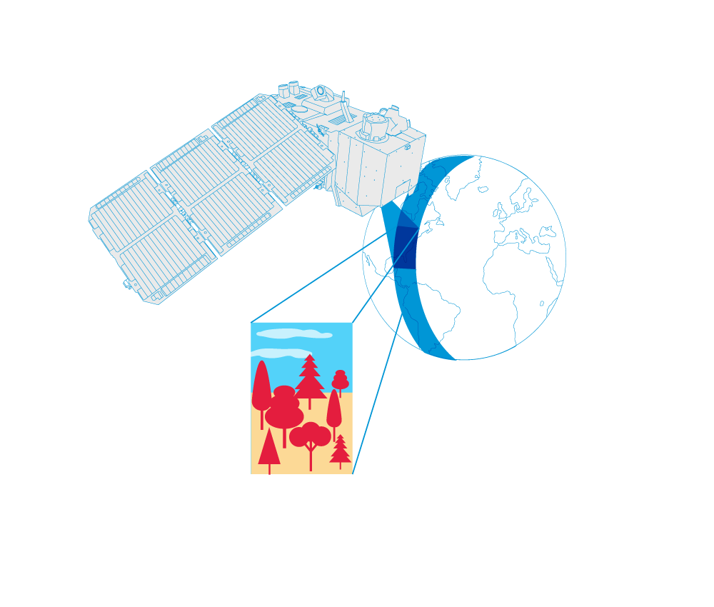
The Magic of Light – Using spectroscopes and colour wheels to study the properties of light
Brief description In this set of eight activities, pupils work individually or in groups to build a spectroscope that can...
Global Stocktake: how space drives climate action
Almost 200 countries are gathering in Dubai to attend the biggest climate event of the year. COP28 – the 2023 United Nations climate change summit – isn’t just another conference though. For the first time,...
Sea ice from space – Investigating Arctic sea ice and its connection to climate
Brief description In this set of three activities, students will investigate Arctic sea ice. First, they will perform a hands-on...
From the Ground and from the Sky- Analysing and understanding images of planet Earth taken from space
Brief description In this set of three activities, pupils are introduced to the idea of remote observation of the Earth...