Project title: Landscape influence on surface temperature in western Andalusia
Team: PMAIR Team
IES Pino Rueda Umbrete Spain 10 Student’s age: 14-15 years old
How does the landscape influence on surface temperature?
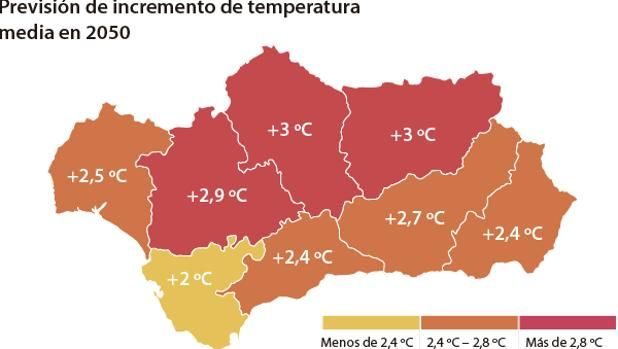
In recent years there has been growing concern about the increase in global temperature due to climate change. Andalusia in the South of Spain, is suffering the consequences of increased temperatures, deforestation and desertification. PMAIR Team has studied the relationship between the landscape (vegetation, mass water, etc.) and surface temperature in different locations in western Andalusia during the hottest months of the year.
We have selected 5 locations around our village: Sanlúcar la mayor (an agricultural village sited in the “Green corridor” a riverside forest near Guadiamar river); Aznalcázar (also sited in the “Green Corridor” and near a pine forest); La Rinconada (an agricultural village close to Seville Town); Ecija (famous for being the hottest place in Spain and called “Frying pan of Andalusia”) and Chipiona (a coast village).
Surface temperatures were obtained from “Red de Información Agroclimática de Andalucía (RIA)” website and satellite images from EO browser (ESA satellite Sentinel-3). Data were represented graphically and analysed with Google Sheets software and published in our website.
Data and images allow us to understand the influence of vegetation, river and ocean on surface temperature. On one hand, areas near riverside o pine forest registered lower maximum temperatures; on the other hand, ocean water had a great influence buffering the temperature.
We have focused our research on 5 locations with different landscapes (Sanlúcar la Mayor, Aznalcázar, La Rinconada, Ecija and Chipiona). Maximum, medium and minimum temperatures were collected daily throughout the months of July, August and September for each location. All data were represented graphically to facilitate the following results:
– The hottest day in 2021 was 14th August with a maximum temperature of 47.3ºC in Ecija, while the temperature in Aznalcázar (Green area) was 43.5ºC (almost 4 degrees lower) and the temperature in Chipiona (coast) was 31.5ºC.
– Same trend was observed for minimum temperatures. The highest, of the minimum, was recorded on 6th September in Ecija (26.8ºC), while the same day on Sanlúcar la Mayor the temperature was more than 4 degrees lower (22.6ºC).
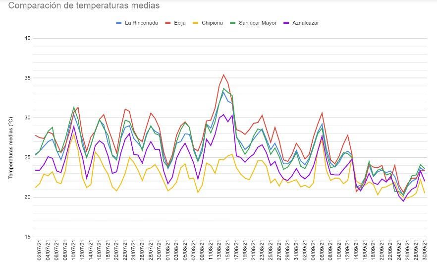
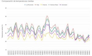
– The day with the highest medium temperature was again 14th August with a record of 35.4 ºC, five degrees over the 30.4 ºC observed in “green corridor of Guadiamar riverside” (Aznalcázar) and ten degrees over the coast (Chipiona, 24.7 ºC).
From the graphical comparison of medium temperatures (Figure 2), a significant difference is observed between different locations depending on the landscape, vegetation and water masses.
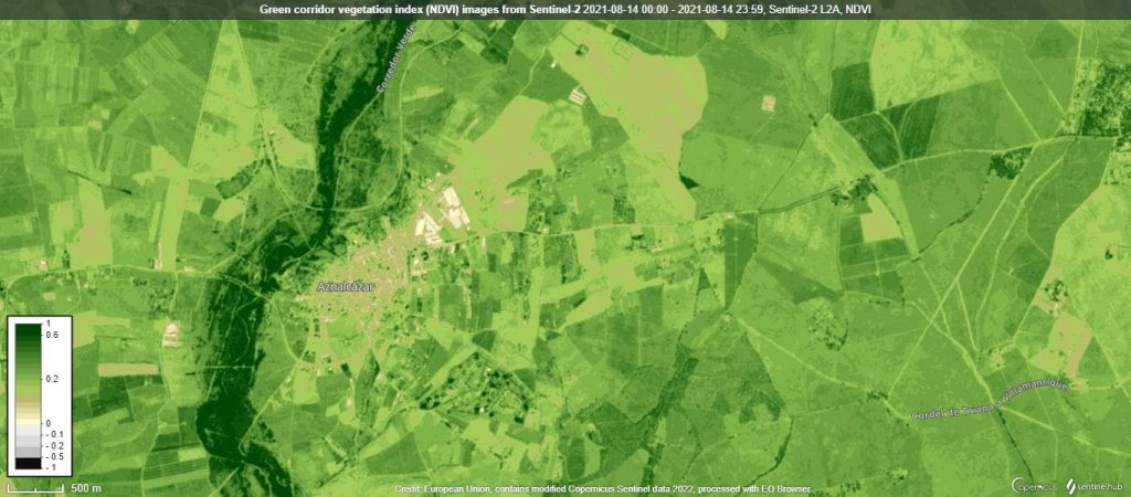
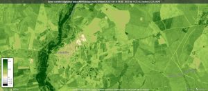
That correlation is confirmed with aerial pictures from ESA Sentinel satellites. The influence of biomass on temperature was studied on the basis of images (Figure 3) from the Sentinel-2 satellite (vegetation index NDVI). Sentinel-3 satellite provided images of surface temperature (SLSTR S7), however we did not find significant differences in the images, possibly due to the extreme temperatures.
In conclusion, we found that locations with masses of water (Chipiona) and vegetation (Aznalcázar) have lower temperatures than low vegetation areas (Ecija), so that, in general terms, deforestation and desertification may accelerate global warning.
Our project has been published on our own website and it has been an opportunity to improve the STEAM skills of our students. For them, it has been a truly exciting experience to become climate detectives for the second year in a row.
Our students have verified the importance of caring for the biosphere and hydrosphere to control the increase of temperature, and we are planning to plant trees as a gesture in favor of green areas.
We are also trying to increase the visibility of recycling containers, especially paper ones, due to the amount of waste generated at the school and the relationship with the trees.
https://sites.google.com/iespinorueda.com/detectives-climaticos/inicio
Projects are created by the teams and they take the full responsibility of the shared data.
← All projects

