Climate Detectives Projects 2022-2023
Project title: Has climate affected the Moy’s river height over five decades?
Team: An Abhainn Mhuaidh
St. Muredach’s College Ballina Ireland 3 Student’s age: 16-17 years old
Using river height as a prime example, are there causes and damages that climate has caused for the river Moy to develop in a negative way?.
We extensively researched records of the Moy from previous years. We spoke to local fishermen and people who use the river in their daily lives. Many anglers exclaimed that the habitat for local fish like the salmon seems to drop due to factors of the river, such as:
Height
Speed
Depth
Light
Temperature
Flow
All aspects from each category influence animals’ habitat.
In our project, we chose to examine the height of the river as data is uncommon regarding the other categories. We also chose this because the country experiences a good portion of wet weather, which commenced our beginning to measure the rain to identify how much the weather changed the height as well .
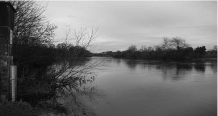
The River Moy’s erosion has caused many problems to natural landscapes and artificial constructions such as the walkway beside the river in our town and a majority of trees and plantlife.
There was a pathway in construction which was abandoned due to unstable grounds caused by the river erosion. We would like to investigate different aspects that relate this issue to river height and its evolution over the five decades
In our project, we have collected various forms of data. Our data consists of a primary source of rainfall covering our town, Ballina, and the river height of the river Moy. We made secondary data for comparison to earlier decades to display the change within the river
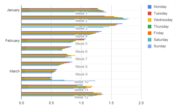
In the results of the graph and table we have created, we can analyse that the water levels have the highest height in January. This is because a majority of rainfall commence in January and slowly deceased to the start of spring.
In February, a decrease of the level of water was recorded. During this month it was roughly the same height and had no major changes.
At the start of March, we had recorded our lowest daily river height which had a huge increase during the second week of March due to an increase in rain.
In conclusion, we have found that with the increase of climate change in the current state of the world it has caused the river height of the river moy to increase especially within the last 20 years as that’s when the speed of climate change has accelerated rapidly in comparison to what it was years beforehand
This is worrying as we are now starting to see climate change affecting our local area slowly but surely and that we do in fact need to change our ways if we want to sustain our local area we all love and cherish
Next time we would like to achieve greater results by examining different areas of the river, more accurate rainfall analysis and bringing a new element of the change in tides that were another influence we discovered as researching the different aspects of river heights
Together we can utilise sandbags to defend against the flooding that is affected by Ireland’s rainy climate. With more research on the aspects of the river, we can develop solutions to stop habitat loss and flooding to occur.
Projects are created by the teams and they take the full responsibility of the shared data.
← All projects