Climate Detectives Projects 2022-2023
Project title: Tourism is coming, coasts are leaving (Kalamaki, Tavronitis, Kolymbari,).
Team: Coastal researchers
1st Experimental Junior High School Chania Greece 18 Student’s age: 12-13 years old, 14-15 years old
What factors contribute to the erosion of the northern coast of Chania.
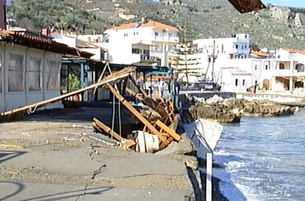
The study presented below focuses on the coastal zone of the northern part of the Prefecture of Chania, Crete, Greece, from the city of Chania to the settlement of Kolymbari. According to personal testimonies of students, rapid erosion of the coasts of the region has been observed in recent years.
In the present work we studied coastal erosion. We, firstly, collected photographs of the area we are investigating from various satellites up to thirty years ago. The first satellite we used is Sentinel 2 and specifically the normalized water index (NDWI) and composite microwave infrared (SWIR). Also, to notice changes over time, we tried to compare the Sentinel 2 images above with Landsat 4-5 images from the 1980s and 1990s for the normalized water index (NDWI). However, the different resolution of the satellites did not allow us to compare Sentinel 2 images with Landsat 4-5 images and detect changes for these periods. Sentinel 2 images, with the appropriate color markers, were used to study the increase in construction and tourist development.
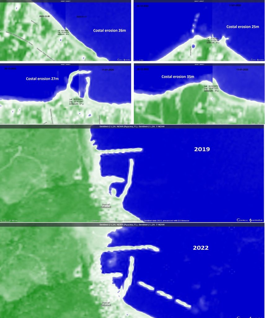
All images are from the Sentinel 2 satellite and of different periods.
The first four pairs of images were taken on 2022-12-26, the newest, and 2020-01-11, the oldest. The first pair of images is from a position east of the settlement of Agia Marina. You observe 26 meters of erosion. The second pair of images is from the center of the settlement of Agia Marina. You notice 25 meters of erosion. The third pair of images is from a location in Limanaki of Platania settlement. You observe 27 meters of erosion. The fourth pair of images is from a position west of the Gerani settlement. You notice 35 meters of erosion.
The following satellite images concern the port of Columvari. The port in the settlement of Kolymbari has suffered serious damage in previous years due to coastal erosion. The first image depicts the port in 2019, while the second in 2022. Initially, it is evident that there are 3 new , parallel to the shore cantilevers. Second change that exists in the image of 2022 is that the port has been artificially expanded. The last change that is observed is that the harbor has small curves around the coastline, meaning that the shape of the coastline has changed at a rapid pace. The survey showed that the new harbor works to protect Kolymbary were completed in spring 2021.
In Crete there is particular interest because the phenomenon of coastal erosion is directly linked to touristic development, which is a key economic activity of our country. Our study found erosion in some parts of the northern coastline of the prefecture of Chania, which ranges from 25 meters to 35 meters. The results of our research match the results of a master thesis of the Mediterranean Agricultural Institute of Chania, written and presented by Giorgos Spanos, in 2022.

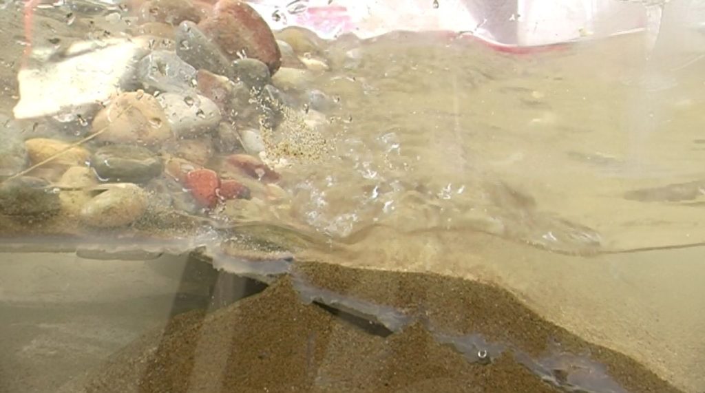
In order to study the phenomenon more deeply, we built a study model of coastal erosion. In the future, using this study model of coastal erosion, we intend to study the individual phenomena that explain coastal erosion, how these phenomena evolve and we are going to calculate the pace at which the shape of a coast changes.
Projects are created by the teams and they take the full responsibility of the shared data.
← All projects